


Basic factors that influenced
the evolution of Burma Part I
1. Geographical factor
Burma: “The highway between India and China” India and China are the world’s biggest and ancient cradle of civilizations. High, snow peaked, rough and steep Himalaya mountain ranges block the direct interaction or travelling between the two of them except for the virtual highway through Myanmar/Burma. So there were a lot of travelers, migrants, victims of disasters and famine, war refugees and etc moving along this Burma Highway and some of them settled in Burma.
In the official Thailand History books, they even claim that all of the Tibeto-Burman groups including Tibet came down from Yunnan stressing that Tibet had made an almost U turn and climbed beck onto the Tibet Highlands.
There was the Burma Road which linked Burma and China. Its terminals are Kunming in China and Lashio in Burma. The road is about 1,130 kilometres long and runs through rough mountain country. General Merrill and General Stillwell built during the colonial times under British. When the Japanese overran sections of the Burma Road the Allies built the Ledo Road, also later known as the Stillwell Road. Ledo Road was built from Ledo in Assam into the Hukawng Valley as an alternative to the Burma Road. It was completed in January 1945 and was renamed Stilwell Road by Chiang Kai-shek. Now China and India are negotiating with Myanmar to build a modern high way liking their countries through Burma including to lay natural gas pipe line from Rakhine to India, Yunnan, China.
(Copied from my own contributions in Wikipedia)
And I would like to use data from Wikipedia and my old Dear Nan letters to continue this series of
Basic factors that influenced the evolution of Burma.
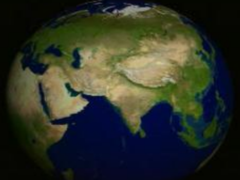
A. Maps (Geography of Burma)
(a) Effects of the Himalaya mountain range between China and India.

(b) Myanmar Neighbours, China and India separated by Himilayan mountain ranges.

(c) Situation of Myanmar as a convenient highway between India and China

(d) Myanmar highway along the valleys with water-supply along it, connecting China and ASEAN.
Indonesians, Malays and Polynesians were believed to be the earliest migrants came down from Yunnan through Burma to their homelands in south.

(d) Strategic situation of Myanmar between its Neighbours (China, India, Bangladesh, Thailand and Laos)

(e) Myanmar in ASEAN.
Myanmar highway, connecting China and ASEAN. Indonesians, Malays and Polynesians were believed to be the earliest migrants came down from Yunnan through Burma to their homelands in south.

(f) Orietation of Myanmar in the world map

(g) Burma or Myanmar

(h) Geography of Burma |
|
Continent |
Asia |
Region |
Southeast Asia |
Coordinates |
22°00′N 98°00′E / 22, 98Coordinates: 22°00′N 98°00′E / 22, 98 |
Area |
Ranked 39th
|
Borders |
Total land borders:
|
Highest point |
Hkakabo Razi
|
Lowest point |
Andaman Sea
|
Longest river |
Ayeyarwady River |
Largest lake |
Indawgyi Lake |
The Encyclopedia of World History
From early times Burma came under Indian influence. By the 3rd century C.E., expanding Hindu peoples had established commercial settlements on the Tenasserim coast and at the principal river mouths, which developed small kingdoms in contact with the Tibeto-Burman tribes of the Irrawaddy Valley. Commercial relations with China were less influential, although an embassy from a Burmese state reached Ch’ang An in 802. (See Burma (Pagan)) See The Encyclopedia of World History. 2001.
Excerpts from the Dear Nan letters of my split personality to his wife.
Now China and India are negotiating with Shwe Bama villagers to build a modern high way liking their villages through our land. Recently Ko Ka Lar’s village chairman U Mus Lim went to Shwe Bama and signed an agreement to lay natural gas pipe line from Ko Ya Khine’s part of our village to Ko Ka Lar’s village.
And there is already an agreement to connect the gas pipe line from Ko Ya Khine’s part of the village to Ko Yu Nan’s village. So these high ways and pipelines would become the renaissance of our forefather’s migration.
Dear Nan, why are you very sensitive, I am just mentioning the coincidences but not supporting those pipe-lines. You already know that I supported your policy of sanctions on SPDC. If you are not short sighted, you could still read our Burma Digest’s strong condemnation of TOTAL in recent issues.
It is funny that those who play with fire and burnt sometimes blamed the fire. Recently one of the ASEAN PM complaint that their state owned oil company suffered some losses because of the sanctions in the host countries they operate. Then why did they foolishly decided to follow their greed to buy the shares of TOTAL and invested more than RM 4000 million in Myanmar/Burma oil exploration and refinery?
Instead of redeeming themselves by supporting the US, UK and EU led pressure on Myanmar Generals for the rapid democratization, they are still blocking them to give protection to those killer criminals? Giving protection to killer criminal illegal cruel rulers are guilty to the Laws of the human and God.
So there were a lot of travelers, migrants, victims of disasters and famine, war refugees and etc moving along the road and some of them settled in our Shwe Bama Village as we are located along their high way through out the history.
Dear Nan, do you now accept the concept that our village was and still is a highway from west Ko Kala’s village to Ko Ta Yoke’s village in the north. People from Northwest of Ko Kala’s village came to our village through Ko Ya Khine’s village.
Since 500 BC Hindu Orrisa village colonists had migrated towards Southeast and settled in lower part of our Shwe Bama village. Later other migrant villagers from the Andhra Dynasty from Ko Kala’s village similarly migrated to our village in 180 BC. Some took the long march on land and then some had sailed here.
Your loving hubby (Ko Tin Nwe)
BO AUNG DIN
See also_
- Basic factors that influenced the evolution of Burma Part I
- Factors that influenced the evolution of Burma Part II
- Factors that influenced the evolution of Burma Part III
- Factors that influenced the evolution of Burma Part IV
- Factors that influenced the evolution of Burma Part V
- Factors that influenced the evolution of Burma Part VI
- Factors that influenced the evolution of Burma Part VII
- The Golden days of the Great Mon Empire I
- Renascences of the Golden days of the Great Shan Empire
- The Golden days of the Great Shan Empire II
- The Golden days of the Great Shan Empire III
- The Golden days of the Great Shan Empire IV
- The Golden days of the Great Shan Empire V
- The Golden days of the Great Shan Empire VI
- The Golden days of the Great Shan Empire VII
Filed under: Analysis, ASEAN, Burma, Burmese History, Burmese Indians, CHINA, culture, English Article, Ethnic Minorities, Genghis Khan, History, India, Malaysia, Migrants, Migration, Minority Races, Mongol invasions, Mongolia, Myanmar, Myanmar History, Tar Tars | Tagged: ASEAN, Burma, Himalayia, History, Indonesia, Malaysia, Migration, Myanmar, Politics | Leave a comment »

+(Small).jpg)


